georead
- mipylib.geolib.migeo.georead(fn)
Returns a layer readed from a supported geo-data file.
- Parameters:
fn – (string) The supported geo-data file name (shape file, wmp, geotiff, image, bil…).
- Returns:
(MILayer) The created layer.
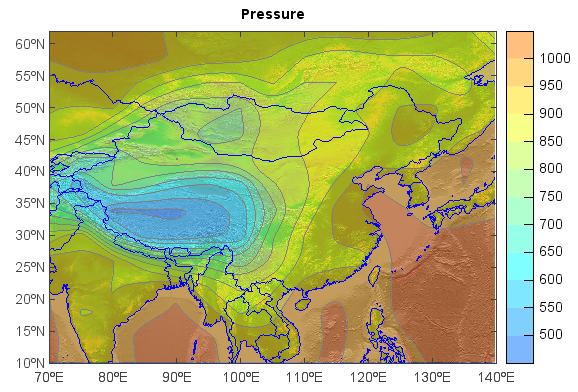
Examples:
f = addfile('D:/Temp/GrADS/model.ctl')
ps = f['PS'][0,[10,60],[70,140]]
lrelief = georead('D:/Temp/Map/GLOBALeb3colshade.jpg')
world = georead('D:/Temp/Map/country1.shp')
axesm()
geoshow(lrelief)
geoshow(world, edgecolor=[0,0,255])
cols = makecolors(20, alpha=128)
layer = contourfm(ps, colors=cols, edgecolor='gray', order=1)
title('Pressure')
colorbar(layer, aspect=12)