Read ASCII file
The asciiread() function was used to read array data from an ASCII file. Some header lines could
be skiped by setting headerlines argument. The shape of the array could be set using shape
argument.
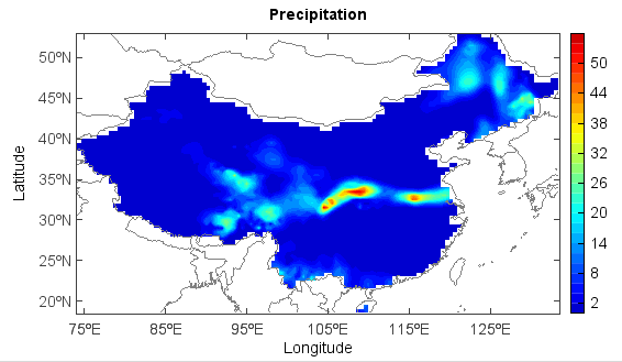
Read grid data from ASCII file:
rain = asciiread('D:/Temp/ascii/SURF_CLI_CHN_PRE_DAY_GRID_0.5-20120702.txt',headerlines=6,shape=(72,128))
rain1 = rain[::-1,:]
x = arange1(72, 128, 0.5)
y = arange1(18, 72, 0.5)
axesm()
geoshow('country')
layer = contourf(x, y, rain1, 20)
title('Precipitation')
ylabel('Latitude')
xlabel('Longitude')
colorbar(layer)
Read station data from ASCII file. numasciicol() and numasciirow() functions were used
to get column and row number of the file:
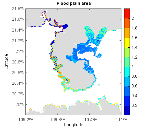
fn = 'D:/Temp/ascii/flood.dat'
ncol = numasciicol(fn)
nrow = numasciirow(fn)
a = asciiread(fn,shape=(nrow,ncol))
lon = a[:,0]
lat = a[:,1]
v = a[:,2]
axesm()
geoshow('cn_province', facecolor=(220,220,220), edgecolor=None)
layer = scatter(lon, lat, v, edge=False, size=2)
xlim(109.2, 111)
ylim(19.8, 21.8)
title('Flood plain area')
ylabel('Latitude')
xlabel('Longitude')
colorbar(layer)