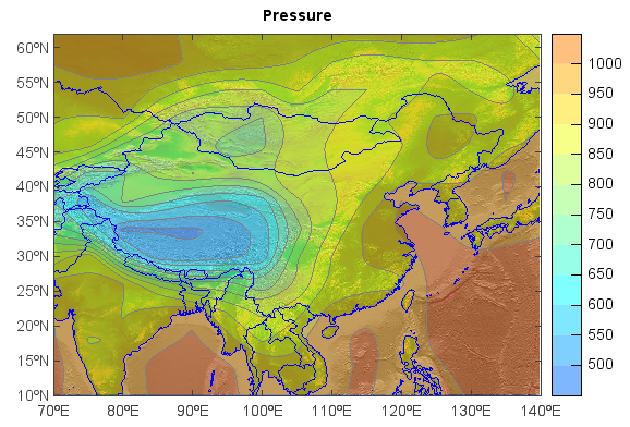
Add image layer
Image file formats of jpeg, png, bmp and gif can be loaded as image layer using georead()
function, and the image can be geo-located by creating geo-location file with the image file.
fn = os.path.join(migl.get_sample_folder(), 'GrADS', 'model.ctl')
f = addfile(fn)
ps = f['PS'][0,'10:60','70:140']
imfn = os.path.join(migl.get_map_folder(), 'global_shade.jpg')
lrelief = georead(imfn)

#Plot
axesm()
geoshow(lrelief)
geoshow('country', edgecolor=[0,0,255])
layer = contourf(ps, edgecolor='gray', zorder=1, alpha=0.5)
title('Pressure')
colorbar(layer, aspect=20)