Map projection
Map projection can be set when creating a map axes using axesm function by projinfo parameter. Projection object can be created using projinfo function with Proj4 style parameters (ref: http://remotesensing.org/geotiff/proj_list ). axism function is used to set projected map extent with a list parameter including start and end longtitudes and start and end latitudes.
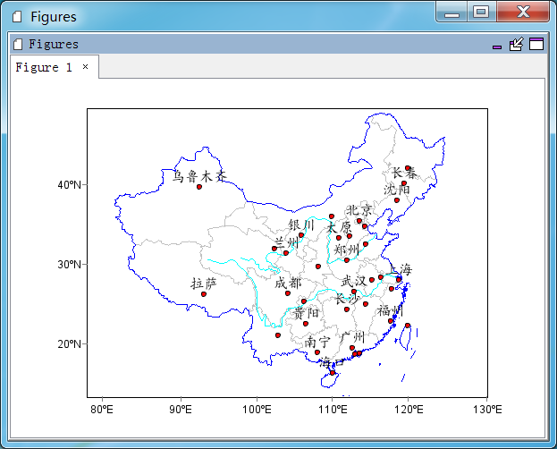
#Plot
proj = projinfo(proj='lcc', lon_0=105, lat_1=25, lat_2=47)
axesm(projinfo=proj, axison=False)
geoshow('cn_province', edgecolor='lightgray')
geoshow('cn_border', facecolor=(0,0,255))
ss = makesymbolspec('line', {'value':'Yangtze', 'color':(0,255,255), 'size':1}, \
    {'value':'Huang He', 'color':(0,255,255), 'size':1}, field='NAME')
geoshow('rivers', symbolspec=ss)
geoshow('cn_cities', facecolor='r', size=4, labelfield='NAME', fontname=u'楷体', \
    fontsize=16, yoffset=15)
axism([78, 130, 14, 53])